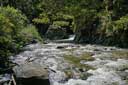
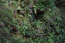
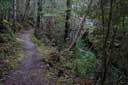
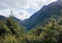
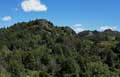
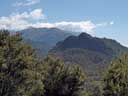
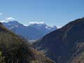
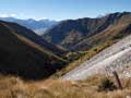
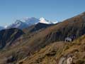
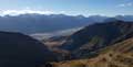
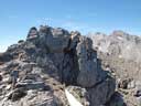
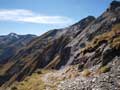
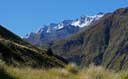
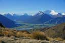
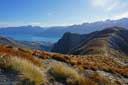
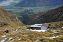
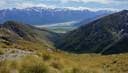
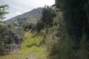
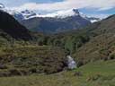
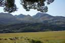
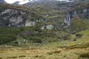
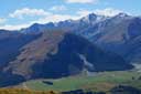
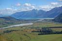
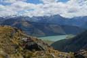
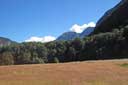
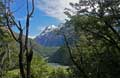
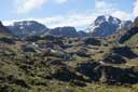
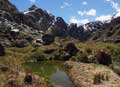
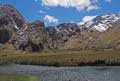
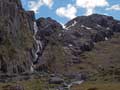
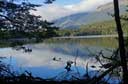
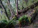
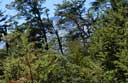
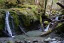
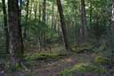
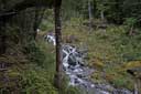
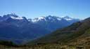
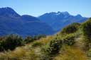
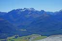
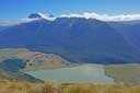
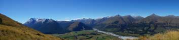
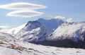
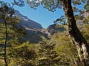
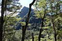
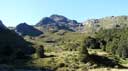
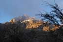
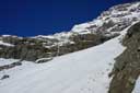
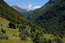
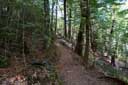
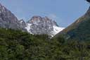
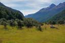
- Mount Crichton Loop (1.5 hours). Start at the car park marked "Access to Mt Crichton Track" which is on the left of the
Glenorchy road, about 10km from Queenstown and 100m past a sign for the Twelve Mile Delta.
(Track start to hut 32min; high point 51min; back 86min.)
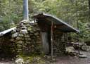
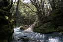
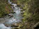
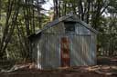
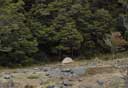
About the hut.
MAP
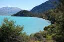
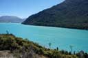
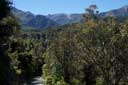
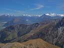
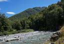
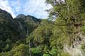
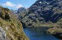
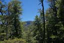
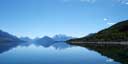
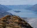
- Twelve Mile to Bobs Cove (2 hours return). Start as above, and follow signs for Bobs Cove.
To reach P387 follow signs for Picnic Point Loop. MAP
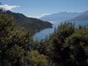
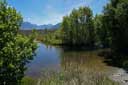
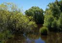
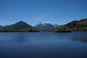
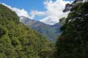
- Glenorchy Lagoon (1 hour return). Go straight at the roundabout in Glenorchy.
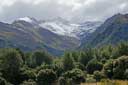
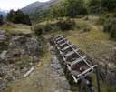
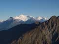
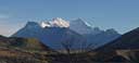
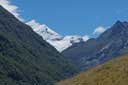
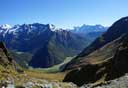
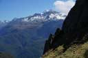
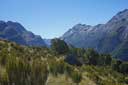
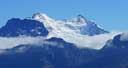
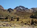
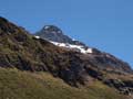
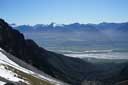
- The Invincible Mine (2 hours return). Off the Rees valley road; the vertical climb is
about 350 metres, but well worth it for the views of the Rees mountains.
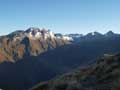
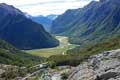
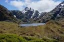
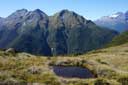
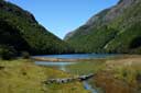
- Lake Sylvan (about 1 hour return). Off the Routeburn road.
- Nature Walk in Routeburn (about 1 hour return). Start up the Routeburn track and follow signs.
 |
 |
 |
 |
 |
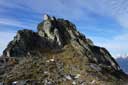
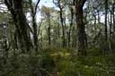
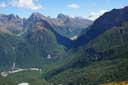
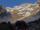
| Crichton Loop |
Crichton Loop |
Crichton Loop |
Crichton Loop |
Crichton Loop |
 |
 |
 |
 |
 |
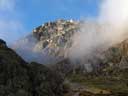
| Crichton Loop |
Crichton Loop |
Crichton Loop |
Crichton Loop |
Crichton Loop |
 |
 |
 |
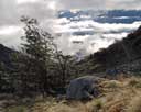
| Crichton Loop |
Crichton Loop |
Crichton Loop |
 |
 |
 |
 |
 |
 |
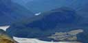
| 12 mile-Bobs Cove |
12 mile-Bobs Cove |
12 mile-Bobs Cove |
12 mile-Bobs Cove |
12 mile-Bobs Cove |
12 mile-Bobs Cove |
 |
 |
 |
| Glenorchy Lagoon |
Glenorchy Lagoon |
Glenorchy Lagoon |
 |
 |
| Invincible Mine |
Invincible Mine |
 |
 |
 |
 |
| Lake Sylvan |
Lake Sylvan |
Lake Sylvan |
Lake Sylvan |
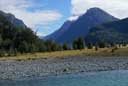
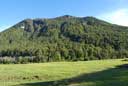
Queenstown-Glenorchy Road
Start at the Whakaari carpark, on the Queenstown-Glenorchy road, about
2k before Glenorchy. Follow signs for Heather Jock hut. Biking up the
easy part of Mount Judah farm road saves about an hour round trip.
 |
 |
 |
 |
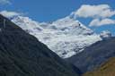
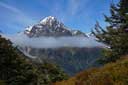
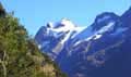
| Earnslaw |
Rock burn peaks |
Cable |
Heather Jock Hut |
 |
 |
 |
 |
| Panorama |
Wakatipu peaks |
Camp |
Jean Hut |
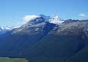
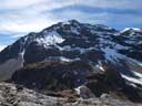
Climb of Mt Alaska
From Heather Jock hut, continue on old mining tracks to the north
ridge of Mount Alaska, and climb the ridge to summit (tussock, scree;
about 4 hours return).
 |
 |
 |
 |
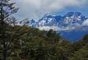
| Mt Alaska |
Earnslaw |
Summit |
From top |
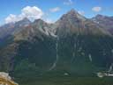
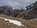
Larkins Slip Hut and beyond
The old mining tracks cross the ridge above Heather Jock hut at about
1440m, and continue up valley to the derelict Larkins Slip hut and
beyond. However, some slips on the track make travel problematic.
 |
 |
 |
| Earnslaw |
Wallers creek |
Beyond |
Start at the Whakaari carpark, on the Queenstown-Glenorchy road, about
2k before Glenorchy. Follow the signs for the Mt McIntosh Loop. Long Gulley saddle is about halfway in time (either direction).
The Buckler Burn is normally only ankle deep in summer, but can be difficult after heavy rain.
Notes: DOC is continuing to restore huts in this area for overnight stays, including the Shickers Hut at 1400m.
Camping is possible near the huts.
 |
 |
 |
 |
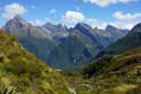
| Earnslaw |
Long Gulley |
Buckler Burn |
Larkin Peaks |
 |
 |
 |
| Descent ridge |
Dart/Rees |
Lake Wakatipu |
If you prefer to ascend (rather than descend) steep rough tracks, you
may wish to do the loop in reverse. The track on the north side of the Buckler Burn starts north of the road
bridge at the second road marker after the guard rail; see Moir's
Guide p.67.
 |
 |
 |
 |
 |
 |
| Earnslaw |
Bonpland |
Mt Alfred |
Dart-Rees |
Earnslaw |
Ridge |
The hut is about 30 minutes above Long Gulley saddle.
The hut has a water tank and bunks, but you may prefer to camp.
The ridge behind the hut is easily reached south of P1663 on a mining track.
However, the views are better from the ridge north of P1663, which is reached on easy tussock. Follow
the ridge north towards Mt McIntosh (1701m) until it becomes difficult.
 |
 |
 |
 |
| The hut |
P1663 |
Mt McIntosh |
P1663 |
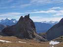
To climb Black Peak, leave the route to McIntosh hut just before the hut and
follow the old mining track towards Black Peak. Climb the final scree
to the top, and return to the Mt McIntosh Loop. The climb of Black
Peak adds about 3 hours to the McIntosh Loop.
 |
 |
 |
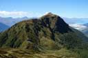
| Black Peak |
Summit |
Temple Burn |
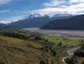
Rees Valley
Follow the track to the Invincible mine in the Rees valley. Continue on the track across
Invincible creek, and climb Muddy Spur to a flat spot c1740m. To here, travel on the ridge is easy.
 |
|
 |
 |
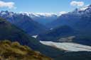
| Muddy Spur |
Invincible Mine |
Invincible Creek |
Invincible Creek |
 |
 |
|
 |
| Hut |
Muddy Spur |
Rees Valley |
Earnslaw |
From Twenty Five Mile hut, it is possible to follow sheep trails on grass and tussock to the Big Devil hut (about 1.5 hours
from the Rees; about 4 hours from the Muddy Creek car park). See Moir's Guide North for the route. The hut itself is locked.
The Big Devil Creek chasm is spectacular --- 30m deep and 2m across. It is easy to find the bridge on the way in, but
on the other side there's some dense scrub and bush with only a small animal track through it. Make sure
you are able to find the track on the way back (no track, no bridge, no dinner).
 |
 |
 |
 |
 |
| Earnslaw |
Osonzac Twins |
Earnslaw |
Head Peak |
Big Devil Hut |
Walking from the carpark at Muddy Creek to Twenty Five Mile Creek takes about 2 hours (when
the Rees is low, it is possible to bike up the farm road; requires several crossings of the Rees). From Twenty Five Mile Creek,
cross the Rees River and head towards the northern part of the shelf on the other side of the valley, about 1k north of Lennox Falls.
The start of the track to Kea Basin is well marked, but you may have to climb over a locked gate and slide under an electric fence to get there.
 |
 |
 |
 |
 |
| Rees Valley |
Rees Valley |
Kea Basin |
Kea Basin |
Kea Basin |
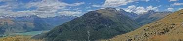
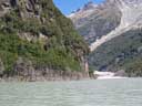
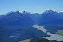
Paradise Road/Dart Valley
The ridge on the true left of the Earnslaw Burn ends in a large cliff, known as as "Lovers Leap".
The spur leading from the Earnslaw Burn to the end of the ridge (above the cliff) can be climbed (easy grass slopes).
Follow the Earnslaw Burn track until you reach grassy slopes leading up to the end of the ridge.
The Earnslaw Burn track is reached from Paradise road. Either turn right onto the last public road (Lovers Leap Road) before the bridge
over the Burn, or turn right onto a short access road just past the bridge (park before the Burn;
ford it; then climb up through beech forest crossing two fence lines to reach the
track with its orange markers).
 |
 |
 |
 |
 |
 |
| Lovers Leap |
Earnslaw Burn |
Grassy slope |
Earnslaw |
Lake Wakatipu |
Earnslaw |
 |
 |
 |
 |
| Earnslaw |
Earnslaw |
Diamond Lake |
Panorama |
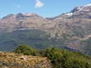
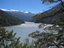
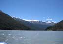
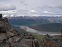
The road to Chinamans Bluff from Paradise is very rough but is usually passable by cars.
There is a good track up the Dart valley.
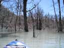
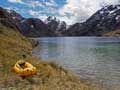
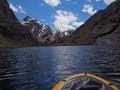
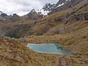
A walk to Sandy Bluff and the new lake formed by the slip in January 2014
makes a good day trip. And you can go for a paddle if you bring a kayak.
 |
 |
 |
 |
 |
 |
 |
| Up Dart |
Dredge Lake |
Paddle |
On Lake |
On Lake |
Bush |
Down Dart |
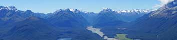
Routeburn Valley
About 15 minutes up the Routeburn track, a track leads off to the
right with a sign "This is not the Routeburn track." Follow it to
Sugar Loaf Pass, and then follow the easy tussock ridge east to a
high point (P1290). It is possible to continue along the ridge to Sugar Loaf Peak (1329m). See
below.
 |
 |
 |
 |
 |
 |
| Sugar Loaf Stream |
Emily Peak |
Earnslaw |
Somnus |
Somnus, Rock Burn |
Rock Burn |
 |
 |
 |
 |
| Bush |
North branch |
Emily creek |
From Emily |
 |
 |
 |
 |
| From Falls |
Upper valley |
Lake Harris |
Lake Harris |
 |
 |
 |
 |
 |
 |
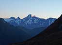
| Mt Gifford |
Summit |
Apirana Pk |
Darran Mntns |
Tutoko |
Martins Bay |
In Old Norse sources, trolls are said to dwell in isolated mountains, rocks, and caves,
and are rarely described as helpful or friendly (Wikipedia).
The Valley of the Trolls is perfect troll country.
It is at the top of Lake Harris, off the Routeburn track. It takes about 3.5 hours
to walk into Lake Harris from the road. Allow 3 hours or so to visit the Valley of the Trolls,
and another 3 hours to return from Lake Harris.
 |
 |
 |
 |
 |
 |
| Routeburn valley |
Lake Harris |
Valley of the Trolls |
Valley of the Trolls |
Valley of the Trolls |
Stream from L. Wilson |
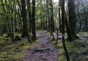
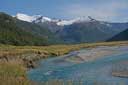
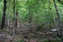
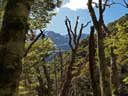
This is mainly a bush tramp, but with views of Lake Sylvan and the mountains. Start
at the Lake Sylvan car park, and follow the track to the Rock Burn, and then back over the Sugar Loaf pass
to the Routeburn (or do the reverse). The side trip to the junction of the Rock Burn and the Dart
adds 30 minutes, but is worth it (if you can dodge the jet boats). The track is a bit rough near the pass,
but otherwise was in good condition (March 2016). Plan for a long day.
 |
 |
 |
 |
| Lake Sylvan |
Bush |
Beans Burn |
Rock Burn |
 |
 |
 |
 |
| Dart |
Bush |
Pass |
Pass |
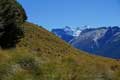
For experienced trampers, this may be the best one-day tramp at the head of Lake Wakatipu.
Cross the bridge to the start of the Lake Sylvan track and head into the bush in the direction of Sugar Loaf.
Follow the ridge over Sugar Loaf to Sugar Loaf pass, descend the track, and bike back to the start.
The bush is dense in places, but is nowhere difficult, and it is possible to follow animal tracks for much of the way.
From the top of the bush (1100m), follow an easy goat track over Sugar Loaf Peak and on to P1285.
The descent from there to the col requires care (but there is plenty of vegetation to hang onto).
Climb through scrub to P1290, and continue along the easy ridge to Sugar Loaf pass.
 |
 |
 |
 |
 |
| Sugar Loaf |
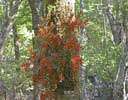
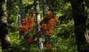
Peraxilla tetrapetala |
Peraxilla tetrapetala |
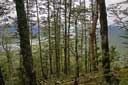
Bush 800m |
Bush 900m |
 |
 |
 |
 |
 |
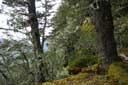
| Bush 1100m |
Humboldt Mntns |
Pluto |
Double Barrel Creek |
Route Burn |
 |
 |
|
 |
 |
| Sugar loaf Peak |
Dart |
Lake Sylvan |
Sugar Loaf Peak |
Sugar Loaf Stream |
The latest edition (2013)
of Moir's Guide North describes a route
from Kowhai Creek (near the end of the Routeburn road)
over to Scott Creek. From the sign "Upper Kowhai no 2 bridge", head up in the untracked bush staying fairly close to the stream.
There is bush lawyer lower down and scrub higher up in the bush. Above the
bush there is steep scree, so this route is for determined trampers only.
 |
 |
 |
 |
 |
| Bush |
Routeburn |
Routeburn |
Kowhai Creek |
From Sugar Loaf |
Follow the Routeburn track to the (named) bridge across Emily creek (2
hours). Emily creek has two main branches, one of which ends in
waterfalls. Follow the other one (true left) up slippery rocks. At the
top, when the scree gets uncomfortably steep, look for cairns leading
out to the left. Follow them (small track) into Emily basin. Cross a snow grass slope above a waterfall
to reach the gulley leading to Emily pass (keep fairly high). Climb scree and rock
in the gulley to reach steep snow grass slopes leading to the pass (3 hours).
Descend straight down the Hollyford side (snow, then scree, then scrub).
When the scrub gets dense, follow the creek.
The start of the track around Lake Mackenzie is well marked (marker, two cairns) but,
initially, it is badly overgrown (December 2014) (2.5 hours). Return by the Routeburn track.
It is possible to shorten
the trip by starting from the Route Burn flats, or break
it by camping in Emily Basin or at Lake McKenzie (reservations required for the latter).
 |
 |
 |
 |
 |
 |
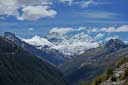
| Somnus |
Earnslaw |
Unnamed Pk |
Emily Pass |
Lake Mackenzie |
Tutoko |
 |
 |
|
 |
 |
 |
| Somnus |
Earnslaw |
Somnus + Earnslaw |
Valley |
Emily Pass |
Darran Mountains |
Glenorchy-Kinloch-Greenstone Road
On the Kinloch road, about 5km after turning off the
Glenorchy-Paradise road, find a small car park on the right. Climb over the stile, and follow the track to the
bushline (orange markers). Then climb a faint track up left to the ridge. Added December 2016. DOC's track
markers now go to the ridge. There are numerous tree falls on the track.
 |
 |
 |
 |
 |
 |
| Mt Alfred |
Mt Alfred track |
Mt Alfred track |
Bush line |
Pigeon Island |
Windmill |
 |
 |
 |
 |
 |
| From top |
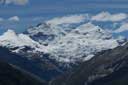
Mount Somnus |
Beans Burn |
Mount Earnslaw |
From top |
 |
 |
| Diamond Lake |
Mount Earnslaw |
Via the south ridge
The ridge can be followed all the way from the road to the top of Mount Alfred. The bush is quite open
and allows for good travelling. This route takes only about half-an-hour longer than the track (3 hours up).
Start a little east of the ridge line to avoid the scrub, and then stay on the top of the ridge.
 |
 |
 |
| Bush |
Mount Earnslaw |
Panorama from near the top of the bush |
In winter
Crampons and iceaxe may be necessary. Probably the ridge is the best route.
 |
| Mount Earnslaw |
The track is an old stock trail, which hasn't been maintained.
However, travel in the bush is quite good. From the Kinloch road, turn right onto the Routeburn road.
The sign is about 3k from the turn off. Climb over two stiles,
climb steeply to the first orange marker pole up the hill, and then
follow a badly overgrown ground trail through scrub to the bush, where
travel becomes easier. The track in the bush is well marked, except at
one point near the top where there are cairns (December 2012).
March 2021: First section of the track has been weed-sprayed, making the ground
trail easy to find. Track is well marked and it good condition.
 |
 |
 |
 |
 |
| Dart |
From bush |
From bush |
North branch |
Upper peak |
North Branch to P1736
Scott creek is a beautiful place, where it is worth spending time. The
old musterer's hut has been removed, but there is good camping on both
sides of the creek at track-end, and elsewhere. The upper part of the North Branch
can be reached using goat trails on the obvious spur on the true left
of the valley. Follow the valley up to the col at the head, and then
scramble up rock and steepening scree to reach P1736 (3 hours).
Photos in second row were taken in March 2021
 |
 |
 |
 |
| Camp |
Tarn |
South branch |
From P1736 |
 |
 |
 |
 |
 |
 |
| Bush |
Scott Creek |
Down creek |
From saddle |
South branch |
North branch |
South Branch to Scott Basin and above
Follow the true-right creek to the col at the head of the South
Branch, if that is where you are going. Otherwise, climb out right,
once the terrain permits this, to reach the south end of Scott Basin.
From here there is good travelling on the true-left of the pinnacle
P1552 to a "lunch spot" at about 1550m. From this point it is possible
to descend to the Scott-Kay pass, or ascend to the snowy pass over to
Death Valley.
 |
 |
 |
 |
| Scott Basin |
Down valley |
Outcrop |
Centaur |
 |
 |
 |
 |
| Easy walking |
P1552 |
P1552 |
P2146 |
The track gives easy access to a remote-feeling alpine valley. Start
at a well marked car park on the Kinloch road. Climb over stile, cross
creek, put boots on. Pleasant track to bushline at 800m (was in good
condition except for some tree falls November 2012; still there December 2014). It is possible
to continue on easy ground to c1100m.
 |
 |
 |
 |
| South side |
Valley head |
South side |
Down valley |
| |
 |
 |
 |
| Down valley |
Down valley |
Cairn |
Richardson range |
To the Bryant glacier and a pass to the Caples
According Moir's Guide North (2013, p32) it is possible to continue on steeper ground to the Bryant glacier and a pass to the
Caples. In early December 2014, I tried to crampon up the old avalanche snow to the Bryant glacier, but was prevented from
reaching the glacier by the
avalanche danger.
 |
 |
 |
 |
 |
| Bonpland |
Richardson Mntns |
Dodgy slope |
Richardson Mntns |
P1653 |
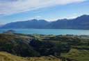
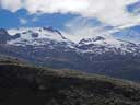
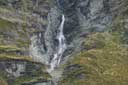
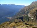
The Lake Rere loop starts at the Greenstone carpark (85 minutes drive from Queenstown; past Glenorchy and Kinloch).
The route crosses farmland to Elfin Bay, and then is mainly in beech forest.
It is very well sign posted.
 |
 |
 |
 |
 |
| Greenstone River |
Mt Earnslaw |
Elfin Bay |
Lake Rere |
Lake Rere |
 |
 |
 |
 |
 |
| Ailsa Mountains |
Track |
Waterfall |
Tooth Peaks |
Caples Valley |
HOME
Email: 
Copyright © 2010, 2011, 2012, 2013, 2014 J.S. Milne.