• Walks near Golden Bay
• Motueka River Valley
• Nelson Lakes
Rakiura (Stewart Island)
• Various.
• 2004/2005 • 2005/2006
• 2006/2007 • 2007/2008
• 2008/2009 • 2009/2010
• 2010/2011 • 2011/2012
• 2012/2013 • 2013/2014
• 2014/2015 • 2015/2016
• 2016/2017 • 2017/2018
• 2018/2019 • 2019/2020
• 2020/2021 • 2021/2022
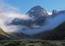
Fork Hut, Huxley
• Walks
• Brewster Hut and Mt. Armstrong
• Copland Valley
• Mount Fox
• Mataketake Tops
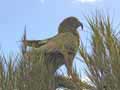
Kea on Mt Fox
• Arthur's Pass
• Aoraki/Mt Cook
• Huxley Valley
• Mount Somers
• Temple Stream
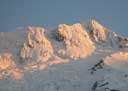
Footstool in winter
• Day Tramps
Mount Alfred; Sugar Loaf Peak; Scott Creek; Glacier Burn; Kea Basin; Lake Rere; ...
• Multi-day Tramps
Dart-Rees; Earnslaw Burn; Steele Creek; Cascade Saddle; Five Pass; Lake Nerine; Theatre Flat; Route Burn; Caples; ...
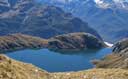
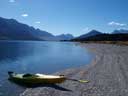
Lake Unknown
• Matukituki: East Branch
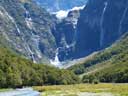
Glacier Burn; Junction Flat; Aspiring Flat; Mount Sisyphus; Ruth Flat; Rabbit Pass.
• Matukituki: West Branch
Rob Roy Valley; Aspiring Hut; Pearl Flat; Valley head; Liverpool Bivvy; French Ridge Hut; Cascade Saddle.
Kitchener
• Day Tramps
• Earl Mountains
• Hump Ridge
• Kepler Mountains
• L. Monowai • Green Lake
• Moraine Creek
• Milford Track
• Mt Titiroa
Ngatimamoe Peak
• Diamond Lake • Dredge Lake
• Green Lake • Lake Adelaide
• Lake Hauroko • Lake McKerrow
• Lake Manapouri • Lake Monowai
• Lake Te Anau • Lake Wakatipu
• West Coast
Head of Wakatipu