
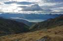
This is a fine tramping peak, about 10 km from Queenstown. The true summit (P1873) is an unpleasant looking block which is probably rarely (if ever) climbed, but it is possible for trampers to reach P1723 on the southeast ridge, and P1845 and P1870 overlooking Lake Isobel. From the peaks, there are views both up and down Lake Wakatipu.
 |
 |
 |
 |
 |
 |
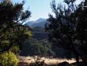
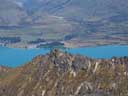
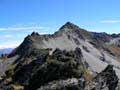
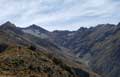
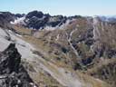
| Ben Lomond | Ben Lomond | Cairn | P1041 | Mt Nicholas | Lake Isobel |
The car park for the Crichton Loop track is on the Glenorchy road about 10k from Queenstown. Start left on the loop track, cross Maori creek on a large foot bridge, and climb to a high point on the track where there is a small track on the right to a "viewpoint" (30min; this is before a large clearing on the track). About 10m past this, a faint track zigzags up the hill on the left. Follow it to reach an old stock track that follows the top of the ridge. Follow this to P1041. On the descent, be careful to keep on the ridge to avoid the bluffs in Maori gulley.
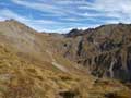
Climb the steepening ridge to P1432, and continue on a goat track up the ridge to P1723 (4.5hrs + 3.5hrs for the descent). Caution: There is no water on this route.
 |
 |
 |
 |
 |
 |
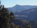
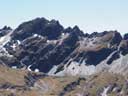
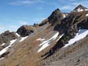
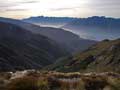
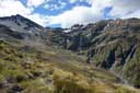
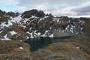
| Wakatipu | Ridge | P1870 | Route | Route | Lake Isobel |
Follow the above route until about 40m below P1723, and then cross to a spur on the western side of the main ridge by a short descending traverse on easy tussock and scree.
Cross the spur, and then traverse easy scree to reach the next spur at the obvious flat spot. Cross the spur (easy) and traverse more scree to reach a shelf to the west of P1870 (5 hrs). The shelf has tarns (the first water on the route) and small camp sites. Continue on the shelf until it is possible to climb easy scree to reach P1845 on the ridge overlooking Lake Isobel (6hrs + 5hrs for the descent). It is also possible to reach P1870 from the shelf, but this is more difficult.
 |
 |
 |
 |
 |
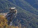
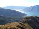
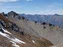
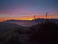
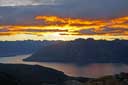
| Upper 12 mile | Sunrise | Lower 12 mile | Route | Upper 12 mile |
 |
 |
 |
 |
 |
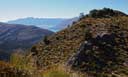
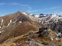
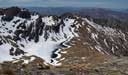
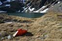
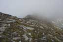
| Upper 12 mile | Camp L. Isobel | Sunrise on climb | Summit fog | L. Isobel |
 |
 |
|||
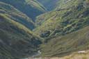
| Bush in 12 mile | Down 12 mile |
After spending 7 hours in our sleeping bags, I woke Richard and David at 4:40am and we left to climb Mt Crichton at 5:20. We went along beside Moke Lake until we reached the southern end, when we went straight up on to the ridge. The last piece up to the ridge was very steep and that, with the fact that it was very hot and we had had no breakfast, made David and me feel very sick. We had breakfast on the ridge and we soon got over our sickness. We went up the ridge all the way from there, having a few good rock scrambles, until we saw the lake and the summit. We then descended down to the lake and walked up scree slopes to the top [P1870] at 12am. On the way back, Richard had a swim in the lake. We descended by a different route. We cut across the southern slopes of the ridge until just above the junction of two ridges and went down to the stream just below the junction. We had to climb over several bluffs on the way down having to climb quite high up for the last one. We arrived back at the camp [at Moke Lake] very tired at 7:10 taking 13 hours 50 minutes for the climb. We had just had tea and were getting into our sleeping bags when we had a cloud burst [5 inches of rain fell at Closeburn in 30 minutes]. The tent didn't keep the water out and our sleeping bags were soaked. We had no alternative but to walk the 11 miles back to Queenstown leaving our packs behind to be collected by car later. We arrived back at 3am after being up for 22 hours 20 minutes of which we spent 19 walking and climbing during which time we walked 23 miles and climbed a 6185 ft peak.
HOME
Email: ![]()
Copyright © 2010, 2011, 2012, 2013 J.S. Milne.