
Mount Somers makes an interesting stop between Arthur's Pass and Mount Cook.
| Time | |||
|---|---|---|---|
| Sharplin Falls car park to saddle above Pinnacle Hut. | 4 hours | Good track. | |
| Saddle to top of Mount Somers. | 2 hours | Easy tussock; occasional cairns. | |
| Return to car park by South Face Track. | 3.5 hours | Rough track; then good track. |
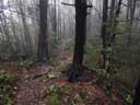
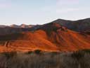
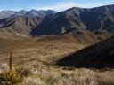
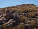
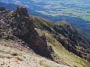
To reach the Sharpley Falls car park, turn off SH 72 at Stavely onto Flynns Road. From the car park, follow the track past Pinnacle Hut to the saddle. Then climb south to the Mt Somers plateau, and follow it to the top. Descend a track to the Mt Somers Track (South Face) and return to the car park. If the weather is bad when you reach the saddle, you can continue on the track over to Woolshed creek, and follow the Mt Somers Loop Track back to the car park. It is possible to camp near the saddle (small creeks) and on the plateau (a few tarns). See DOC's brochure "Mt Somers Track" and "Day Walks" (Shaun Barnett).
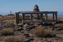
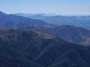
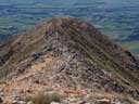
Click on thumbnail to view a larger version.
 |
 |
 |
 |
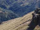 |
| Track | Saddle | Saddle | Plateau | Boyers Stream |
 |
 |
 |
 |
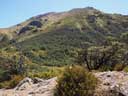 |
| Top | From top | Descent ridge | From descent | Mount Somers |
HOME
Email: ![]()
Copyright © 2013 J.S. Milne.