
This is one of the best two-day tramps at the head of Lake Wakatipu. MAP
| Walk | Time | Comments | |
|---|---|---|---|
| Track up Earnslaw Burn to top of bush | 4.5h | Rock bivvy; camp sites | |
| Walk to the head of valley | 3h return | Open flats | |
| Return by the ridge on the true left | 7h | No track | |
| Moir's Guide North (2013) p62; Topo E40 Earnslaw or CB10/CA10. | |||
 |
 |
 |
 |
 |
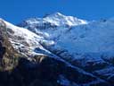 |
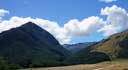
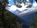
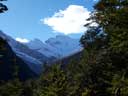
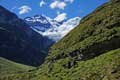
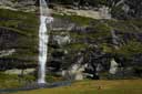
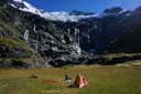
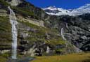
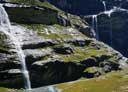
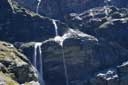
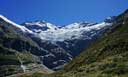
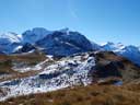
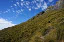
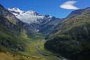
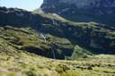
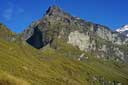
| Earnslaw Burn | Earnslaw Burn | Mt Earnslaw | Turret Head | Upper Valley | Mt Earnslaw |
 |
 |
||||
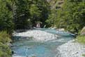
| Down valley. | Earnslaw Burn. |
 |
 |
 |
 |
 |
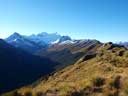 |
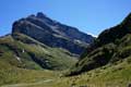
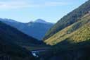
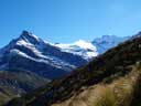
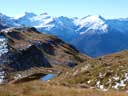
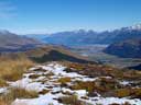
| Upper Valley | Forbes Mntns | Ridge | Wakatipu | Centaur Peaks | Earnslaw Burn |
 |
 |
 |
 |
 |
| Down valley | Traverse | Upper valley | Saddle | Saddle |
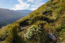
Above the bush, the valley is open flats (easy travelling and many possible campsites).
To descend the ridge on the true-left of the Burn, go about 500m down the track through the bush to a large side stream (open views) and climb the spur on the true left of this. There is no track (apart from the occasional animal track), but travel is fairly easy. Once out of the bush, sidle right and up easy slopes to reach the ridge (c1480m). Moir's says to descend the ridge, but I found it more prudent to dodge the rocky bits on the ridge (c1300m) on the right. Once you can see down to the start of the track, you can head down anywhere on the open grassy slope (easy ground).
Caution: The Earnslaw Burn is not in a protected National Park, and helicopters sometimes land tourists in the valley.
HOME
Email: ![]()
Copyright © 2010, 2011, 2012, 2013, 2015 J.S. Milne.