Side trip up the Kaya Khola (21/10 -- 25/10)
According to the book "High Asia", Jimmy Roberts did
a reconnaissance of the Dhaulagiri massif in 1954, during which
he and Ang Nyima climbed Putha Hinchuli 7246m (alias Dhaulagiri
VII) via its northeast face. It appeared from the map that this
face is most accessible from the Kaya Khola, a side-stream of the
Barbung Khola which is directly across the valley from Kakkot.
One of my plans for the trip was to take a look up the Kaya
Khola.
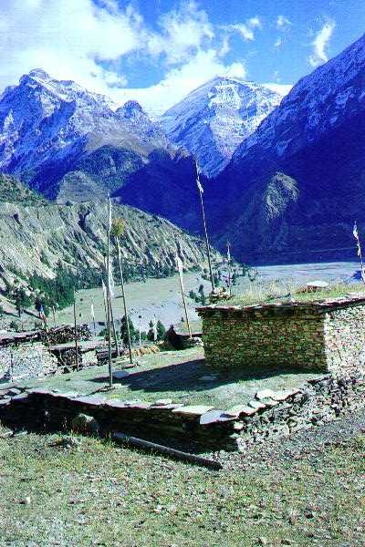
Kakkot, with the Kaya Khola behind.
From Kakkot the Kaya Khola looked very unpromising: a deep gorge with very steep slopes everywhere. However, the villagers had found a way through the precipices to some pastures in the upper part of the valley where they grazed their yaks during the monsoon. My porters were exhausted after 12 days walking (or, so they said), and so I hired two locals (one to serve as a guide and porter; the other to provide company for the first on his return). They knew no more English than I know Tibetan, but communication was not a problem.
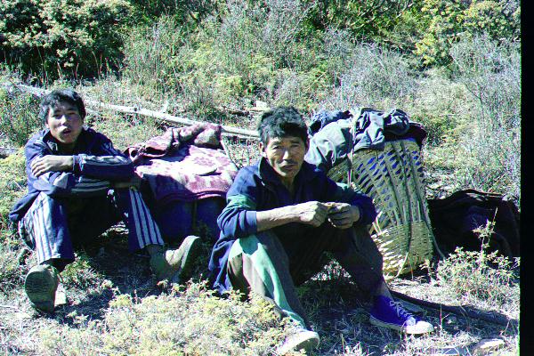
The Kakkot porters
The three of us left Kakkot early on October 21. Tarjan assured me that he would institute a rigorous fitness program so that the Tamangs would be in top shape when I returned.
The villagers and I climbed to the ridge to the right of the Kaya
Khola, where we were met with a dazzling view of very steep
slopes. I was astonished that there could be an easy way through
them.
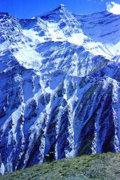
View from the ridge. The peak is Punji Himal.
We dropped down the other side of the ridge to a large overhanging rock, under which we spent the night. When I lit my little propane stove, one of the villagers was amazed: he had never seen such a thing. The main part of the floor under the rock was strewn with ashes and soot from cooking fires. This didn't deter the villagers, who threw their blankets on the soot, wrapped themselves in the blankets, and had a very comfortable night. Being (somewhat) more fastidious, I slept less comfortably.
The Tibetans have a very simple attitude to washing: they don't. It is true that there is a photograph of a Tibetan washing in Snellgrove 1981, p 176, but the text makes clear that he was only doing it to humour a Sherpa travelling with Snellgrove. I was more in sympathy with this attitude than the Tamangs, at least in the sense of "When in Rome..." Later in the trip the Tamangs began to slyly suggest that I might be a Tibetan in disguise. This would explain, they said, why I didn't speak Nepalese, why I was taller than them (all that good nak milk while young), why I was so little affected by the altitude, and why...
The next day, we wound our way through the precipices to a
large grazing area, and on to a small camp site at about 4700m
(15,500 ft). The villagers returned to Kakkot while I set up my
camp. Being alone and at ease in such surroundings is a profound
experience.
The route in to the high camp had been easy, but any significant
showfall would make it into a death trap. Fortunately, after the
rain of a few days earlier, the weather had become very settled,
with scarcely a cloud.
At this point, I was only about two-thirds of the way up the Kaya Khola. The day after I arrived at the high camp, I walked up a little valley behind (west of) the camp for a view.
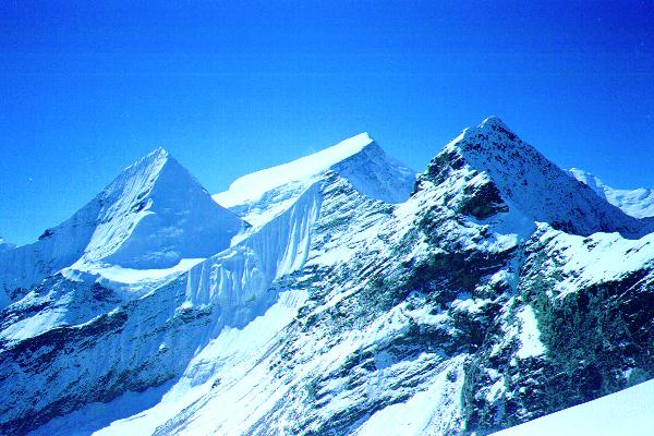
The south wall of the little valley was closed by this beautiful peak c6,500m (unnamed as far as I know).
The north wall of the little valley was formed by the peak, Punji Himal, that we had seen on the way up. From the little valley, the way to the east peak of Punji Himal was steep broken rock with a snow cap, while the way to the west peak was a glacier topped by a small rocky nob.
The next day, I left before daybreak, startling the blue sheep grazing near my tent, and climbed the glacier on the west peak. Its slopes were gentle, but heavily, and somewhat dangerously, crevassed. The views were spectacular.
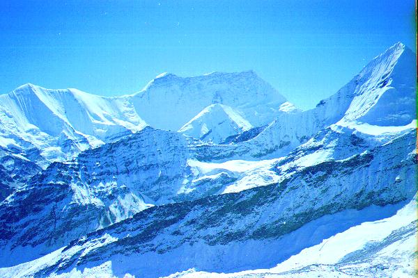
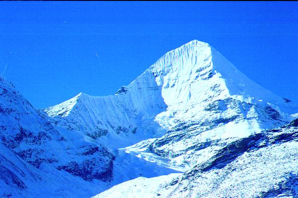
Churen Himal 7371m from on Punji Himal.
The peak in the centre is Putha Hiunchuli 7246m
The upper slopes of Putha Hiunchuli looked very tempting, but it was still a long steep way up the valley. With no trail, and no knowledge of a route up the valley, I decided not to try to go further, and returned the following day to Kakkot.