The road west of Pokhara ends at Beni, on the banks of the Kali Gandaki. The town of Jomson lies north of Beni on the Kali Gandaki, and the villages of Dhorpatan and Sahartara complete a rough rectangle:
| Sahartara | Barbung Khola, Mu La ------------------------ |
Jomson |
| | |
|Kali Gandaki | |
| Dhorpatan | ------------------------ | Beni |
There is a large popular trail from Beni to Jomson, and the occasional trekking group goes from Beni to Dhorpatan and Sahartara. The map shows a trail leading east from Sahartara up the Barbung Khola [river] to the village of Tareng, and then over a 5800 metre (19,000 ft) pass, the Mu La, to Jomson. My plan was to follow this trail, and so complete the circuit:
Beni > Dhorpatan > Sahartara > Jomson > Beni.
But Nepalese maps are notoriously unreliable, and no one in Kathmandu knew whether the route was possible. We wouldn't find out until we got there.
Sahartara is in the region of northwestern Nepal known as Dolpo. Because the geography makes Dolpo more easily accessible from Tibet than from the rest of Nepal, it has had closer cultural ties with Tibet than with the rest of Nepal. For many years, Dolpo was a centre of Tibetan resistance to the Chinese occupation of Tibet, and so was completely closed to foreigners (except employees of the CIA). Much of it is still a restricted area. After the Chinese invasion of Tibet and the coca-cola invasion of the rest of Nepal, it is the last place on earth where authentic Tibetan culture survives.
There is an account of an early journey through Dolpo in David L. Snellgrove, Himalayan Pilgrimage, 1981, and spectacular photos in Eric Valli, Dolpo: Hidden Land of the Himalayas. See also the books by George B. Schaller (Stones of Silence) and Peter Matthiessen (The Snow Leopard).
I arrived in Kathmandu on October 5, and spent it and the next day arranging the trip. We should have left Kathmandu for Beni on October 7, but a one-day strike had been called by the Communist Party (Maoist) [not to be confused with the Communist Party (Marxist-Leninist), which is currently the main opposition party in the Nepalese parliament]. For about four years, there has been a Maoist guerrilla movement in Nepal whose aim is to replace the current multi-party democracy with a "one-party democracy". According to reports, about 1000 people have been killed, 80% of them Maoists. The strike was called to protest the brutal tactics of the police. Brutal or not, the police seem to be winning, and the movement is in decline. The strike, however, was very effective, probably because of the Maoists' threat to firebomb violators.
We left Kathmandu early on October 8 in a Tatamobile (small covered pickup truck). Heavy rains on the 6th had caused some mud slides across the road, which delayed us, and we didn't reach Beni until dark.
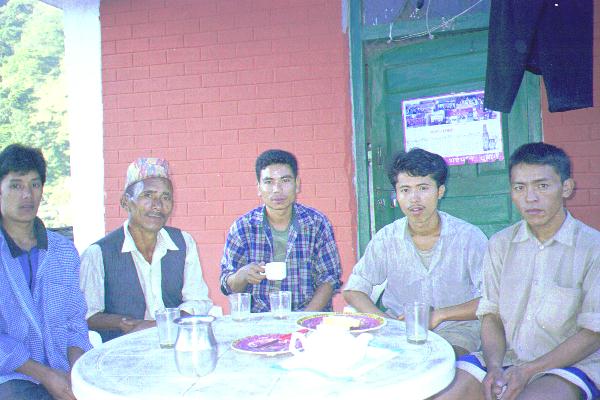
With me were Gunjaman Tamang (sirdar), Tarjan Tamang ("kitchen boy"), and three Tamang porters. Also Thulo Tamang from the trekking agency in Kathmandu came with us. All the Tamangs were from the same village, and were friends. Since I had known Gunjaman and Thulo for many years --- Gunjaman had been with me on six previous treks and Thulo had organized many of them --- we were a happy and cohesive group, mostly.
The crew: Gunjaman is second from left, Tarjan is in the middle, and thefastestporter is at right.
During the first three days we climbed from Beni (800m, 2700ft) to the Jalja La [Pass] (3414m, 11200ft). We then descended gently to Dhorpatan (2842m, 9320ft). On the first day the porters were very slow, but they assured me that this was only because they had been loafing in Kathmandu, and that they would get faster as they got fitter. They did.
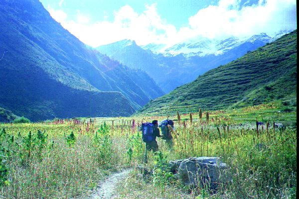
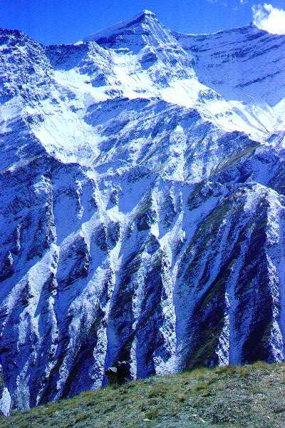
This should have been the least interesting part of the trek, especially as I had walked the first two days twice before, but every time I go to Nepal I am amazed again at how spectacular the views are on even the least interesting sections of the treks.
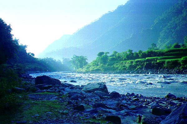
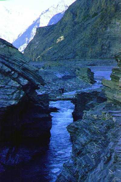
The view, only a couple of hours after we had left Beni.
We had hired two additional porters at Beni, expecting to replace them at Dhorpatan, but because of the festival of Dasain we were unable to hire any (according to Gunjaman, the pay they were asking was "more than high"). Thus, when we left Dhorpatan the porters were carrying very heavy loads, and it took us three days (instead of the usual two) to reach the twin villages of Pelma and Yamakhar. These are the only villages between Dhorpatan and Sahartara.
From now on, there were no lodges. In traditional Nepalese fashion, when we arrived at a village, we would ask around for a house we could stay in. We would either cook on the fire of the house or on our own kerosene stoves. Usually, I'd sleep on the flat roof of the house. Where there was no village, we would camp.
From Dhorpatan we climbed north to the Phagune Dande pass (4054m, 13,300ft).
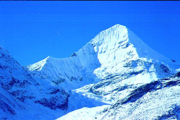
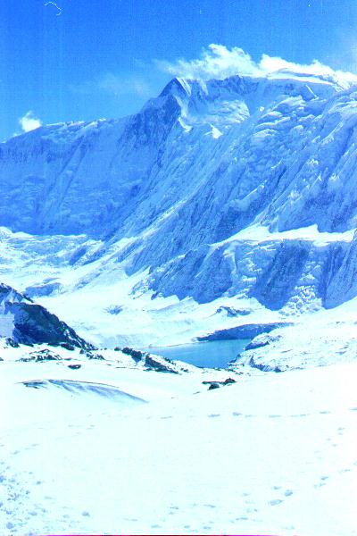
View north from Phagunde Dande pass. The two peaks are Putha Hiunchuli (7246m), left, and Churen Himal. There is a wall of 7000m (23,000 ft) peaks running from Putha Hiunchuli in the west to Dhaulagiri II (7715m) in the east, which we would skirt on the left (west) to reach Sahartara. The Barbung Khola runs behind (north of) the wall of peaks.
l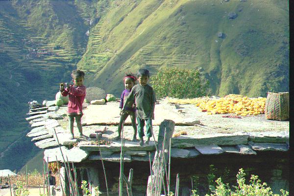
Children on the flat roof of a house in Pelma. The village of Yamakhar can be seen behind them across the river.
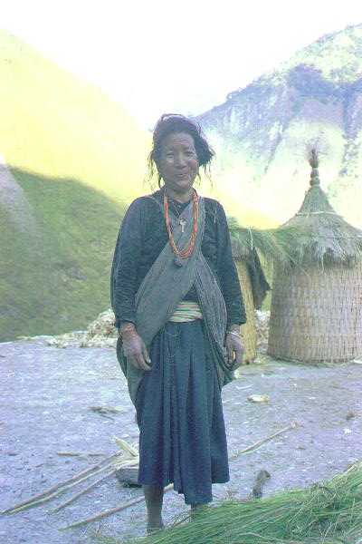
A woman on the roof of her house at Yamakhar. Behind her are storage bins.
According to Bezruchka, Trekking in Nepal, Pelma and Yamakhar are "populated by Kham Magar, a fascinating ethnic group that continues shamanistic traditions closest to the classic Northern Siberian custom".
We were able to hire two porters at Yamakhar, and after crossing several more passes, the highest of which was 4500m, we reached Sahartara (c3000m).
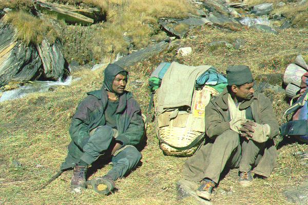
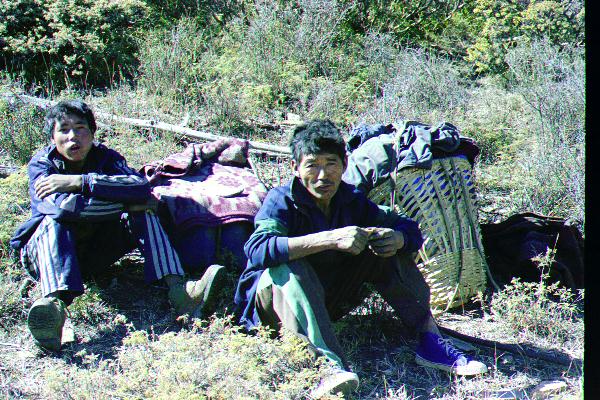
The Yamakhar porters.
Just before Pelma, we saw this bizarre poster on a tree, showing the heroic red army destroying that of the imperialist lackeys (I think).
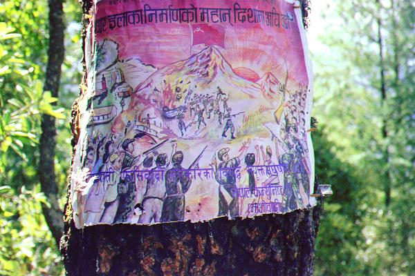
No one would tell me what it was doing there. Later, it became clear that it meant we were entering the territory of the Maoist guerrillas.
As they passed through Pelma, Gunjaman and Thulo were "invited" to contribute 500 rupees (about $7) to the local Maoist school.
The day we left Yamakhar, while I was walking ahead of the others, I met a young man carrying a gun over each shoulder. Since this is an area of Nepal in which some hunting is allowed, I assumed that he was connected with a hunting party, exchanged friendly greetings with him, and continued on my way. The Tamangs later told me that he was in fact a Maoist guerrilla. However, they said that the guerrillas' fight was only with the police (and government), and was no concern of ours.
The next day, while I was again ahead of the others, I met two grim faced young men walking the other way carrying guns. This time there were no friendly greetings. I did, however, take a close look at their guns. They were muskets from about the time of the Napoleonic wars! When the Chinese invaded Tibet in the 1950s, the only weapons the Tibetans had to defend themselves were muskets.
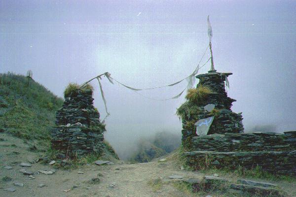
From time to time we would see the hammer and sickle painted on rocks and on prayer flags. This one, on a small pass, marked the end of the Maoist territory.
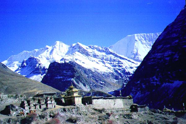
The village of Sahartara is about 200m above Barbung Khola. Here, we were happy to learn from the owner of the house we stayed in that he had been to Jomson over the Mu La, and that it was not a difficult route unless there was snow. Thus, our prospects were good for completing the circuit.
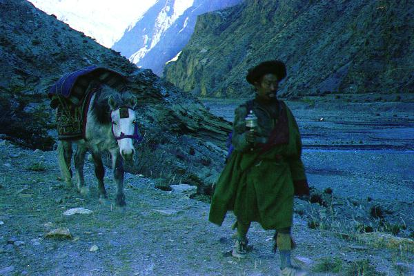
At Sahartara there was a group of trekkers, who were planning to fly out from Jupla, about two days walk down the Barbung Khola. They were the only non-Nepalese we were to see for over three weeks. From now on, the locals were ethnic Tibetans, who called themselves Gurungs.
Tamangs are also descended from Tibetans who "went out to the low land" (that's what "Tamang" means). They migrated so many centuries ago that their language has evolved to the point that they can no longer understand Tibetan. However, most Nepalese speak Nepalese, often as a second language, and the Tamangs could converse with the villagers in Nepalese. The Tamang scriptures are in Tibetan, and so, for a Tamang to be a lama, he must be able to read Tibetan.
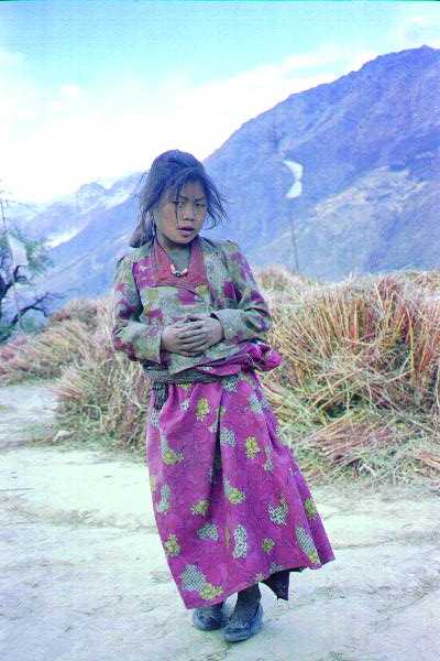
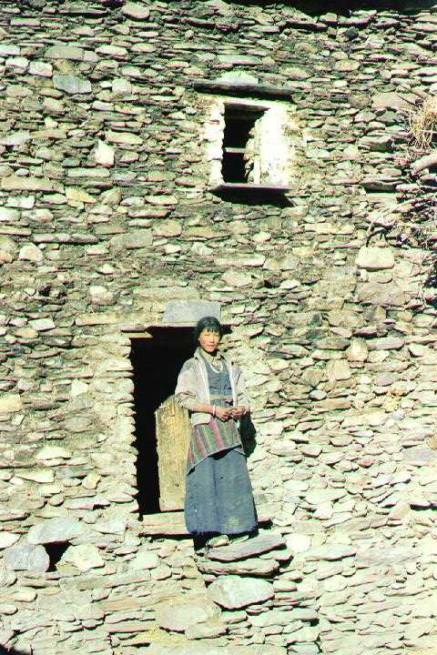
Young girl at Sahartara (on the roof of the house we stayed in).
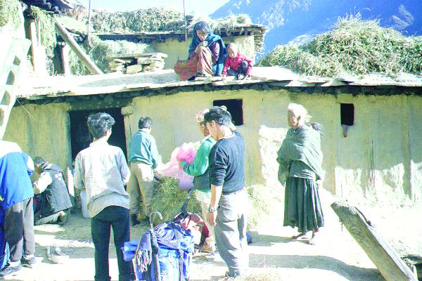
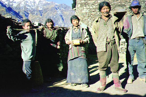
The crew packing up at Sahartara. Thulo scratches his head at right, while the villagers watch intently.
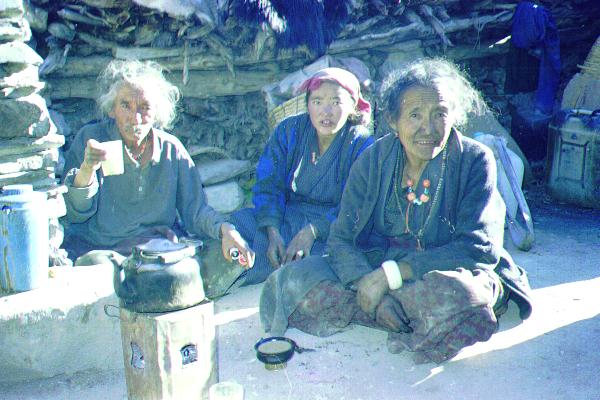
Each morning that we stayed in a village, there would be the pantomime of the paying of the bill. A figure would be named; shocked horror expressed; angry words and glares exchanged; then, when it appeared blows were to be struck, agreement would be reached, and the parties would return to their happy smiles.
From Sahartara, we hired two porters, and walked east up the Barbung Khola to the village of Kakkot.
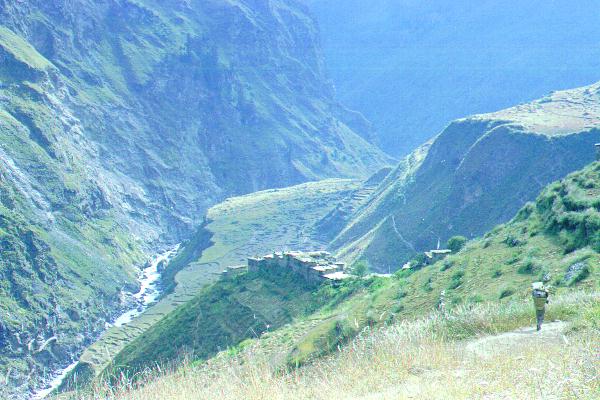
Tarjan descending from Sahartara to the Barbung Khola
We stopped at the collection of houses seen in the preceding photo to buy kerosene.
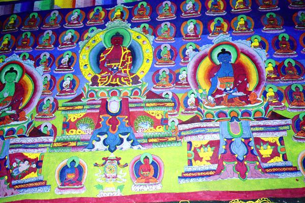
Buddhist paintings.
On the afternoon of the day we left Sahartara, we had the first rain of the trip. It became quite heavy during the early part of the evening, and in the morning there was an ominous coating of snow down to about 4000m.
Thulo and Gunjaman, well equipped for the rain. Behind is a side valley to the Barbung Khola.
On our arrival at Kakkot, the Tamangs bought a goat, which they dispatched and dismembered with amazing skill for people of the Buddhist faith.
According to the book "High Asia", Jimmy Roberts did
a reconnaissance of the Dhaulagiri massif in 1954, during which
he and Ang Nyima climbed Putha Hinchuli 7246m (alias Dhaulagiri
VII) via its northeast face. It appeared from the map that this
face is most accessible from the Kaya Khola, a side-stream of the
Barbung Khola which is directly across the valley from Kakkot.
One of my plans for the trip was to take a look up the Kaya
Khola.
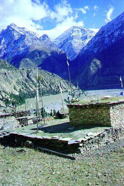
Kakkot, with the Kaya Khola behind.
From Kakkot the Kaya Khola looked very unpromising: a deep gorge with very steep slopes everywhere. However, the villagers had found a way through the precipices to some pastures in the upper part of the valley where they grazed their yaks during the monsoon. My porters were exhausted after 12 days walking (or, so they said), and so I hired two locals (one to serve as a guide and porter; the other to provide company for the first on his return). They knew no more English than I know Tibetan, but communication was not a problem.
The Kakkot porters
The three of us left Kakkot early on October 21. Tarjan assured me that he would institute a rigorous fitness program so that the Tamangs would be in top shape when I returned.
The villagers and I climbed to the ridge to the right of the Kaya
Khola, where we were met with a dazzling view of very steep
slopes. I was astonished that there could be an easy way through
them.
View from the ridge. The peak is Punji Himal.
We dropped down the other side of the ridge to a large overhanging rock, under which we spent the night. When I lit my little propane stove, one of the villagers was amazed: he had never seen such a thing. The main part of the floor under the rock was strewn with ashes and soot from cooking fires. This didn't deter the villagers, who threw their blankets on the soot, wrapped themselves in the blankets, and had a very comfortable night. Being (somewhat) more fastidious, I slept less comfortably.
The Tibetans have a very simple attitude to washing: they don't. It is true that there is a photograph of a Tibetan washing in Snellgrove 1981, p 176, but the text makes clear that he was only doing it to humour a Sherpa travelling with Snellgrove. I was more in sympathy with this attitude than the Tamangs, at least in the sense of "When in Rome..." Later in the trip the Tamangs began to slyly suggest that I might be a Tibetan in disguise. This would explain, they said, why I didn't speak Nepalese, why I was taller than them (all that good nak milk while young), why I was so little affected by the altitude, and why...
The next day, we wound our way through the precipices to a
large grazing area, and on to a small camp site at about 4700m
(15,500 ft). The villagers returned to Kakkot while I set up my
camp. Being alone and at ease in such surroundings is a profound
experience.
The route in to the high camp had been easy, but any significant
showfall would make it into a death trap. Fortunately, after the
rain of a few days earlier, the weather had become very settled,
with scarcely a cloud.
At this point, I was only about two-thirds of the way up the Kaya Khola. The day after I arrived at the high camp, I walked up a little valley behind (west of) the camp for a view.
The south wall of the little valley was closed by this beautiful peak c6,500m (unnamed as far as I know).
The north wall of the little valley was formed by the peak, Punji Himal, that we had seen on the way up. From the little valley, the way to the east peak of Punji Himal was steep broken rock with a snow cap, while the way to the west peak was a glacier topped by a small rocky nob.
The next day, I left before daybreak, startling the blue sheep grazing near my tent, and climbed the glacier on the west peak. Its slopes were gentle, but heavily, and somewhat dangerously, crevassed. The views were spectacular.
Churen Himal 7371m from on Punji Himal.
The peak in the centre is Putha Hiunchuli 7246m
The upper slopes of Putha Hiunchuli looked very tempting, but it was still a long steep way up the valley. With no trail, and no knowledge of a route up the valley, I decided not to try to go further, and returned the following day to Kakkot.
I got down to Kakkot about an hour after dark. To my surprise, the Tamangs were sleeping already. They had planned to make an excursion the next day up the slopes behind Kakkot but, instead, we walked up the Barbung Khola to the next village, Tareng. As we went up the valley, we entered a rain shadow behind the Putha Hiunchuli-Dhualagiri II wall to the south of us, and the ground became very barren.
Gunjaman crossing a bridge over the Barbung Khola
It was a long day to Tareng, and we met only one other traveller.
At the house we stayed in at Tareng there was another traveller, an elderly woman who was the area's money-lender. She was travelling around collecting interest.
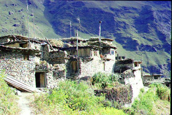
At Tareng, the Barbung Khola turns north, but instead of following it we headed southeast up a tributary to the village of Mukut (c4000m, 13000ft), where we spent the night.
The entrance to the village of Mukut.
The family (except for the mother) in whose house we stayed at Mukut. The son (at right) served as a guide and porter for us to the next village.
One of the daughters standing by the main door to the house.
We had hired a porter in Tareng, and we hired another at Mukut, so that from now on the porters were carrying only light loads.
From Mukut, we climbed to a camp site at about 4900m (16000 ft), and early on the following day we set off for the Mu La (c. 5800m, 19000 ft).
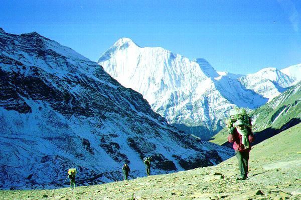
On the climb to the Mu La, with Tarjan leading the way. The peak behind is Dhaulagiri II.
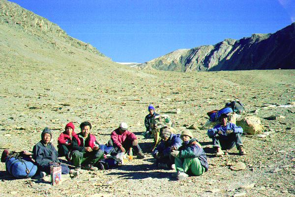
A rest stop on the way to the Mu La. The Tareng porter is at left, Thulo is third from the left, and the Mukut porter at right.
Everyone moved surprisingly quickly considering the altitude. On the last 200m (vertical) to the pass, a very steep switch back, something of a (slow motion) race developed to the top (won by the Mukut porter and Tarjan). For the Tamangs, this was the highest they had been, and everyone was very happy that we had overcome the main obstacle to completing the circuit. The views of Dhaulagiri II and elsewhere were very impressive.
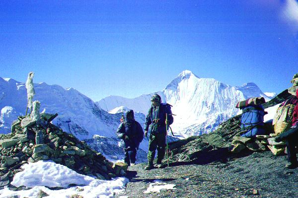
Gunjaman and Thulo arriving on the Mu La
From the Mu La, we descended on frozen snow, which required some step-cutting, and then down a long valley to a campsite at about 5000m (16,500ft). It had been a very long day. During the night, one Tamang porter suffered from mild altitude sickness. He seemed O.K. in the morning, but his load was shared among the other porters. The next day we crossed two more passes, the higher of which was only a little lower than the Mu La, and then had a long descent to the village of Sangda (4100m, 13448ft).
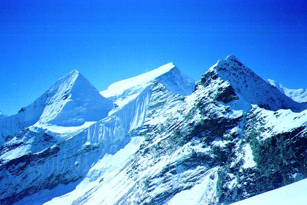
View east from the last high pass. The saddle in the distance is the Thorong La (5400m). The distant valley running north-south in front of the Thorong La is the Kali Gandaki, our goal.
It had been a hard three days from Mukut, and so we spent a day at Sangda. While the Tamangs rested, I went for a walk.
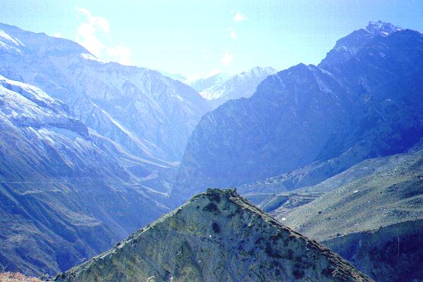
A view looking back at where we had come from. The terraced fields of Sangda can be seen at lower-right. Above them is a high ridge that we had crossed the day before. There is a shorter trail that follows the river (gorge) down, but we were told it was dangerous, and that some people had been killed on it recently.
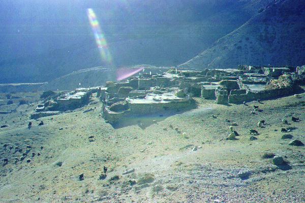
The entire village of Sangda. Yaks and goats graze nearby.
When I returned, the Tamangs were having tea with our neighbours. More accurately, the Tamangs were drinking Tamang tea, while the villagers were drinking Tibetan tea.
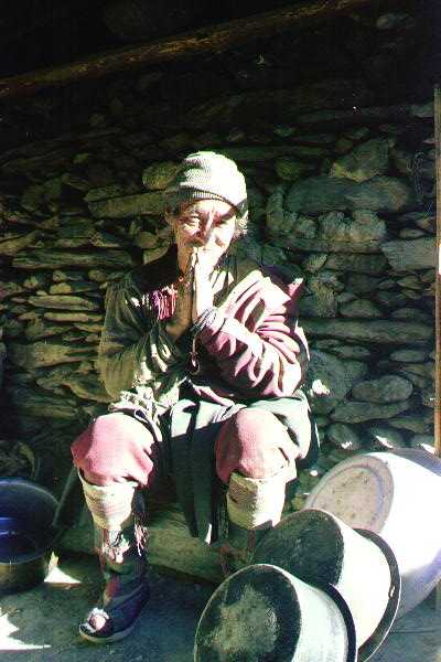
Our neighbour (upper picture) was very rich --- he owned 70 yaks. He told me he was an old man, and that when you are old it is good to pray often. At this point, he gave me such a searching look that I could only agree: yes, indeed, when you are old it is good to pray often. The village had no monastery, but the lama was planning to build one.
As was common in these villages, he and his brother were married to the same woman. They had 5 sons and 4 daughters. The lower picture shows the brother, a daughter, and the wife.
Gunjaman assured me that two men, one wife, was very bad. It does seem a curious custom. Genetics suggests that you should be less jealous of your brother than of others, but I'm not sure how this works in practice.
The next day, an easy walk took us to another village, also called Sangda. From there it was a very long day to Jomson. We left at day-break, and with few stops reached the next village, Phalayak, in mid-afternoon.
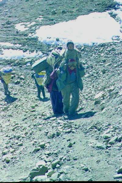
A young family returning home to Sangda; some travel first class; the rest of us walk.
Tilicho Peak and Nilgiri Peak. The village of Phalayak is in the trees at lower right.
When we reached Phalayak, we stopped in at a (randomly chosen)
house. In typical Tibetan-Nepalese fashion, the woman of the
house welcomed us hospitably, especially when we told her how far
we had come, and plied us liberally with chung and apples.
It was dark by the time we reached Jomson, which was perhaps as
well, because it is a very ugly town, full of soldiers and
tourists. But I was able to stay in a hotel room with attached
toilet and hot shower and with clean sheets on the bed. Let it be
recorded that I did avail myself of the hot shower, and that by
midday of the next day I was none the better for it.
A very popular trek, the Annapurna circuit, crosses the Thorong La [Pass] from Manang to Jomson. The guide books mention that a more interesting and difficult crossing can be made near Tilicho Peak, but for many years the route had been closed (it provides too good a view of an army camp). In Jomson, we learned that the route is now open, and so Thulo, Tarjang, thefastestporter, and I set off up to the pass. The first day we climbed to campsite at about 4200m.
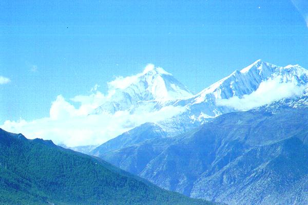
View across the valley to Dhaulagiri I.
The next morning, when we set off for the pass, Thulo (unlike me) gave his extra clothing etc. to Tarjan to carry. Then he set off very fast, perhaps with the hope of finally leaving me behind. If so, he was disappointed, and, after a stop, Tarjan and I left him behind. Next Thulo insisted that the obvious trail was not the correct one (he had been to the pass before). When Tarjan and I eventually refused to follow him, he went on ahead, and shouted down that he had found a good trail, which, when we joined him, we saw he hadn't. Finally (mercifully) he returned to the camp leaving Tarjan and me to climb to pass alone.
Tilicho Lake and Tilicho Peak from the pass.
On the descent, Tarjan surprised me by showing signs of fatigue for the first time on the trip. According to the other Tamangs, he is only fast going up hill; going down, he is nothing special.
We spent the night at the campsite, and returned to Jomson in the morning to rejoin Gunjaman and the other two porters. In the afternoon we walked down the Kali Gandaki to Tukuche. Since by then the usual unpleasant wind was blowing up the valley, and I was weary, the afternoon walk was the only one of the whole trip I didn't enjoy.
The Kali Gandaki [river] rises in Tibet and flows through the Himalayas to the Indian plains. In the night the high dry Tibetan plateau gets very cold. When the morning sun warms the rocks, they heat the air, which rises and pulls a strong wind up the Kali Gandaki. Attempts have been made to harness it to produce electricity.
Tukuche, like many even much more remote Nepalese villages, had electricity, a satellite dish, and a TV in most houses. It was quite an unpleasant contrast to where we had been. In the evening, while I (as usual) read, the Tamangs watched TV.
We then ambled down to Tatopani in a day and a half, where I spent the afternoon reading while the Tamangs washed. Since we had a spare day, I decided to cross over Poon Hill back to the road, rather than continue down the Kali Gandaki to Beni.
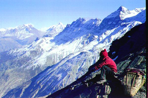
On the climb to Ghorapani, thefastestporter, feeling frisky with light load and an afternoon's rest, noticed I was following on his heels and, deciding to have some fun, zoomed off. For the next 30 minutes we climbed the hill at speeds of up to 3000 feet/hour (vertically) as measure by my wristwatch/ altimeter/ compass/ barometer/ verticalspeedometer/ andIdon'tknowwhatelse. In revenge, I stole his basket.
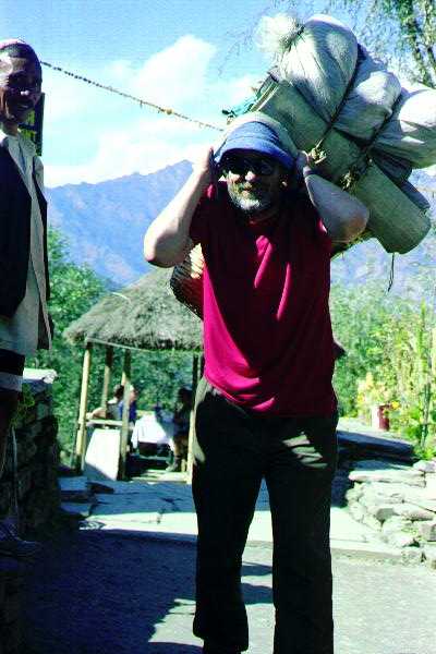
Me, pretending (not very successfully) to be a Nepalese porter. Gunjaman at left. [I don't shave either.]
On the last day, Thulo and I climbed Poon Hill to watch the hundreds of tourists watching the sun rise on Annapurna and Dhaulagiri.
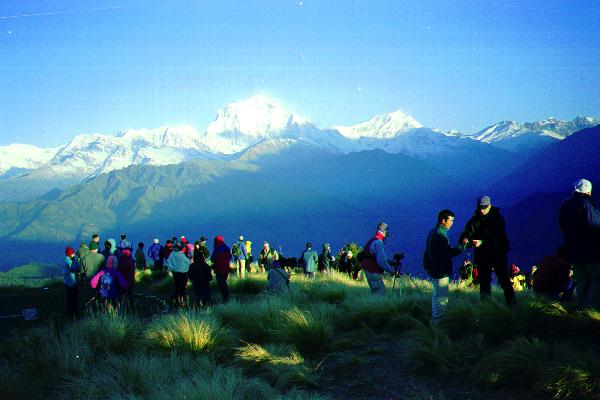
Some of the hundreds and hundreds of tourists; Dhaulagiri behind.
Then we descended to the road, where the Tatomobile was waiting for us, having been summoned by telephone from Jomson.
The next day we left early, and got back to Kathmandu about 1pm. The following morning I said goodbye to everyone, and took a plane to Bangkok. By midday on November 12, I was back in Ann Arbor.
Copyright 1999 J.S.Milne.