Argentina 2003: Tupungato and Mercedario, J.S. Milne
In the southern summer of 2001/2002, I climbed Aconcagua and some other peaks in Argentina. This year I would return and attempt the next two obvious high mountains, Tupungato 6570m and Mercedario 6770m. Since about 4000 people attempt Aconcagua each year, I expected a few hundred would probably attempt these peaks. In fact, very few do.
In Search of Tupungato
My first problem was to find out how to get to Tupungato. Whereas there is a whole guide book devoted Aconcagua, I could find little on Tupungato. Biggar (The High Andes, a guide to the whole of the Andes) says that there are three approaches to the mountain, each taking 3-4 days: from Chile; from Punta Vacas in Argentina following the Rio Tupungato; and the classic Argentine approach from the village of Tupungato. He also says that the climb of Tupungato via its north ridge is easy except perhaps for "a steep snow gulley to gain the summit block". Kelsey (Guide to the Worlds (sic) Mountains) says less: he attempted the approach from Punta Vacas but was unable to cross the Rio Tupungato.
I would try the classic approach. This starts from the village of Tupungato and follows the Santa Clara valley to a pass over to the Tupungato valley.
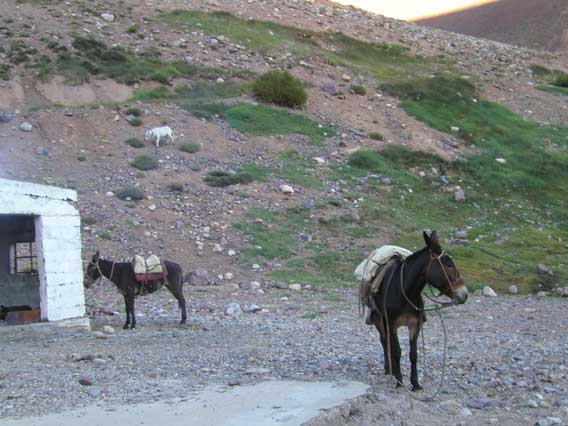
28.01.03 Arrived in Mendoza
I was met at the airport by Mr Orviz of Casa Orviz, who drove me to buy cooking gas at his shop, and then drove me to Hosteria Don Romulo in Tupungato to arrange horses/mules. Since I had allowed myself only 16 days for both peaks, I wanted to set off immediately, but Romulo told me that the mules wouldn't be ready until tomorrow, and the last person who tried to go up the Santa Clara valley without them drowned crossing the river, and the five before that were swept away but didn't drown [at least, I think that is what he said (I don't know Spanish)]. So I spent the night at the Hosteria.29.01.03 To Camp 2, Ref. Real de los Bayos 3250m
In the morning Ramon (Romulo's brother) gave me a copy of a sketch map, which included a list of the camps and their altitudes (see below). In the absence of any other maps or information, this was extremely useful. After I had given my name and passport number to the local police, the national gendamerie, and army, Ramon drove me to the Refugio Condor, where the horses and mules were, and then to the Rio Santa Clara, where I started walking. Ramon gave me copious directions, none of which I understood, except that I was to wait for the horses at the first ford. So I crossed a bridge over the Santa Clara, and headed west following the north bank of the river. The pampas soon gave way to foothills as I followed a disused road. On the first two crossings of the river there were bridges, but the third was a nasty ford, so I stopped for lunch. After about 10 minutes, my horsemen and pack mule arrived. At each ford, the horses and mule would cross, and then one rider would dismount so that the other could bring his horse back for me.
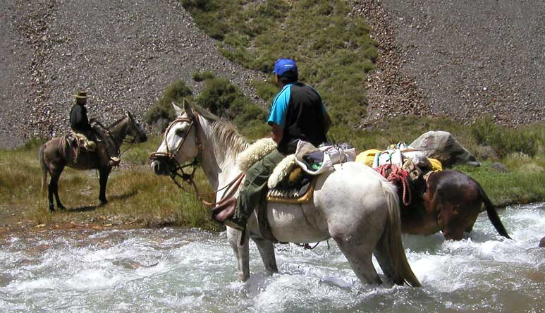
Crossing the Rio Santa Clara. The pack mule has got into a little difficulty,
and was standing in the deepest swiftest part of the river. The horses had to
come back and help it.
After about 5 hours, we headed south up a side valley to a derelict refuge, where we spent the night.
30.01.03. To Camp 3, 4267m
Next morning we reached snow after about 3 hours walking, which caused the horses to turn back (it seems horses won't cross snow). For the next seven days, I would be alone.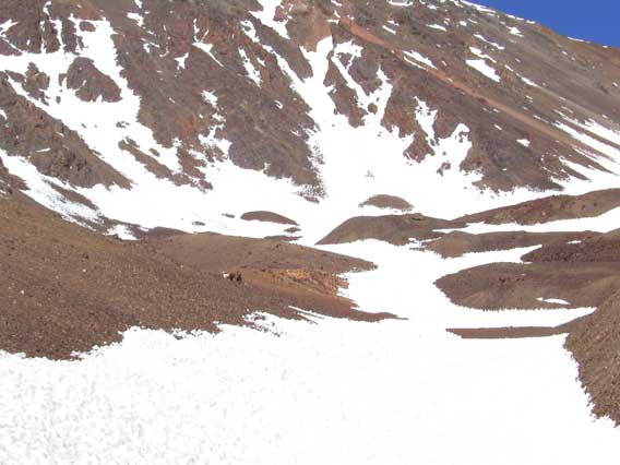
The horses head back to Tupungato.
According to Ramon's guide, it was a nine-hour walk from Camp 3 to Camp 4 over a 4600m pass, so although it was still early, I set up camp, and decided what gear I really needed for the rest of the trip: clothes 8lbs; climbing gear 5lbs; pack/tent/sleeping 13lbs; stove, gas etc. 3lbs; food 12lbs; miscellaneous 9lbs, for a total of about 50lbs (a little under 25kg). My only "luxury" was the new Penguin translation of Don Quixote (1lb 8oz).
The camp site was very small and windy, and it was the only site all trip without running water.
31.01.03. To Camp 4, 3471m
The next morning I carried my pack over the Portezuelo del Azufre 4600m in a high wind, and descended to the Tupungato valley.

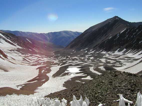
View west from the pass, showing the start of the descent into the Tupungato
valley. Penitente in the foreground.
It was at this point I realized that I had to cross the Rio Tupungato to reach the mountain, and the Rio Tupungato is notoriously uncrossable without mules, at least lower down. From near my camp it looked to be a raging silt-laden torrent. Since it is fed almost entirely by melting snow, it should be lowest in the morning, and so I would try it early.
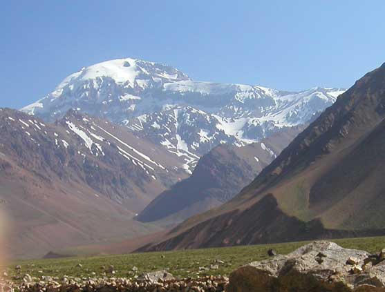
Tupungato from Camp 4.
1.02.03. To Camp 5, 4080m
I left at 7:10am, just as the rays of the sun were hitting the top of Tupungato. The river still sounded fierce in the morning. After half an hour I reached the river, decided on a good spot, and, to my joy, crossed it without too much difficulty. The water was only a little above my knees, but the current was so strong that I was forced to cross diagonally down stream. Despite not being deep, such rivers are dangerous because if you lose your footing you can be flung against the rocks by the current. Once across, I headed west up a valley that seemed to be leading to the lowest point on the ridge north of the summit of Tupungato. Higher up, I was forced into several unpleasant stream crossings, but eventually emerged into a more open area. By climbing above the stream on its south side, I found the next camp site (a few tent positions scratched out in the stones).
Camp 5, with the route to the Chile-Argentina border behind.
2.02.03. To Camp 6, 5155m
After the exertions of the last two days, I felt lazy, and waited for the sun to hit the tent before starting to pack up. I headed up towards the low point on the ridge above my tent. Alas, what had looked to be an easy snow slope turned out to be a horrible maze of penitentes, some 4 metres high. About 100m below the ridge, I was forced to take my pack off, and bash my way up to the ridge using my iceaxe.
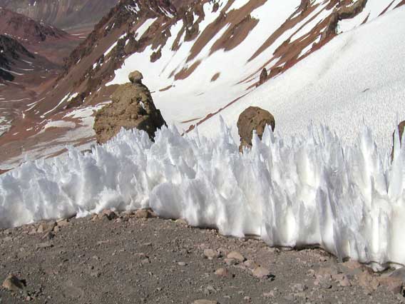
Penitentes. Under some circumstances the surface of the snow melts unevenly
forming dimples. Contrary to what one would expect, the bottom of the dimples
melt faster than the top, until the spikes can be 4m from base to top.
I returned and got my pack. The ridge was 4760m, and it had taken me 5 1/2 hours.
I was to spend the next 3 days mostly on the Chilean side of the ridge.
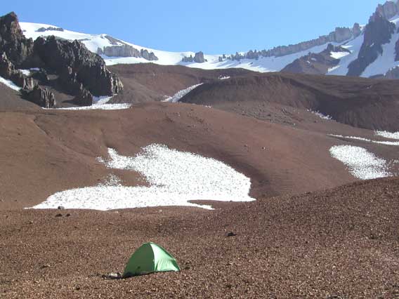
Down the Chilean side of the ridge, I saw a few tents. I followed the slope to the right of the main ridge to a small trail leading up from the Chilean side, which climbed to a beautifully sheltered campsite where I would spend the next three nights.
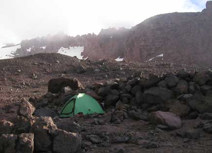
Camp 6, 5155m.
3.02.03. Rest and acclimatize.
Spent the day reading Don Quixote. During the day, some climbers came up from the Chilean tents, passing only a few hundred metres away from my tent, and returned down.
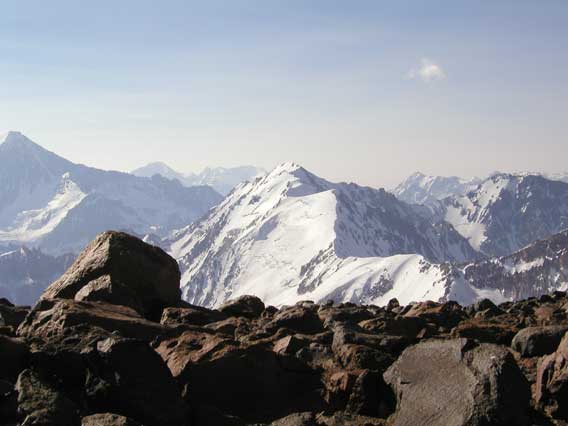
View north from near Camp 6. The peak is only 5047m, so why is it so glaciated?
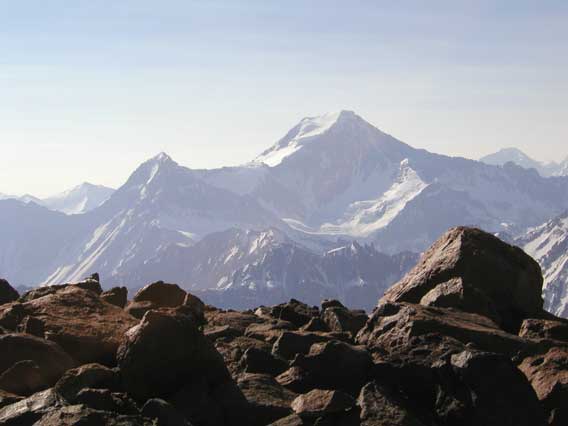
A little west of the previous photo. The peak is a little over 6000m.
4.02.03. Summit bid.
Left for the summit at 6:05am, shortly before it got light. I climbed up onto the broad easy north ridge of Tupungato and followed it towards the summit.
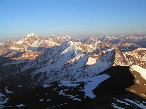
Early morning view --- Aconcagua is the peak at far right.
The summit is protected by a ring of cliffs, that turned out to be steeper than they looked from below, especially as the rock is very loose. The route follows the obvious weakness, which is the "steep snow gulley" on the left of the ridge. Unfortunately, instead of snow, the gulley consisted mainly of hard water ice, or worse, powder snow on ice.
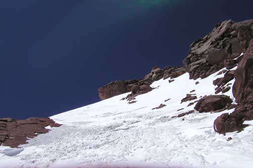
Looking up at the summit gulley
I climbed 35m up the gulley, but felt uncomfortable on the ice since neither my iceaxe or my crampons were penetrating the ice. I was prepared for hard icy snow, but not hard water ice.
View from my high point
Thus, I returned to the bottom of the ice, and had lunch. According to my GPS, my high point was 6305m, about 250m below the summit.
About 12:30 I headed down, and reached my tent at 4pm feeling very tired.
5.02.03. Descent to Camp 5, 4080m
I had told the horsemen that I would get back to Camp 3 on the 6th. To do that comfortably, I should reach Camp 4 in the Tupungato valley today, but that would require crossing the Tupungato river in the afternoon, something that was too dangerous. Thus, today I had an easy day descending to Camp 5 (in 3 1/2 hours).
6.02.03. To Camp 2, 3250m
I packed and left at 6:15am, a little before it was light, in order to reach the Tupungato river before it had been swollen by the sun-melted snow. Hurried down the creek, and reached the river at 8:45am. It was a disturbing sight, but I had no choice but to cross. This time I stepped in a hole in the murky silt-laden water, and came close to being swept away.

Looking back at the Rio Tupungato after my second crossing.
I passed Camp 4 about 9:15, and set off to make the 1100m climb back to the Portezuelo del Azufre 4600m. At 11:15, I stopped for 2 hours to have lunch, and dry my boots. By 4:30 I was at the top of the pass, and at 5:30 I was met by two gauchos near Camp 3. It was a great relief to be able to change my heavy climbing boots for light trekking shoes, and give my gear to the pack mule. By the the time I reached the refugio at 7:45pm, I had been walking for 11 1/2 hours. One of the gauchos reached the refugio and promptly vomited. It was my only reminder on the trip that altitude sickness exists.
7.02.03. To Camp 1 and Tupungato village
Walked back to Refugio El Condor in 5 hours, and then was driven back to Tupungato village, where I had a shower, a large steak, and a wonderful bottle of Tupungato wine. To my surprise, the Rio Santa Clara had been several inches higher than on my way in. On one crossing, the force of the current had driven my horse below the ford, and it had had to fight its way back up. [If your horse is swept away in a river, hang onto it, because it is sure to get out, or so they say.] One reason I had gone so much later this year was so that the rivers would be lower, but apparently there had been an unusually large amount of snow the previous winter.

The gauchos.
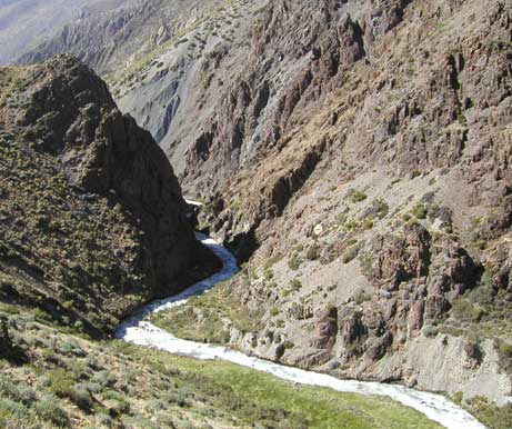
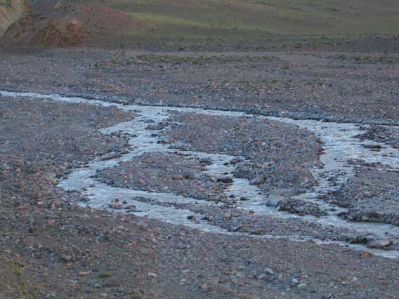
Rio Santa Clara.
8.02.03. Exit
Mr Orviz arrived shortly before noon to drive me to Mercedario. My relations with Romulo, Ramon, the horsemen, etc., which had been very happy, suddenly turned sour when, just as I was leaving Ramon demanded more money. When I arrived, Mr Orviz had negotiated with Romulo for the horses, and I had paid the complete bill for the horses and for nights at the hosteria before and after my trip. Now Ramon was claiming I had paid for the horses only one-way (nonsense), that I had asked for extra horses on the return (doubly nonsense), etc. Too bad.
Below is the table of camps, their heights, and the time to reach them from the previous camp, as given to me by Ramon, as well as the heights measured by my GPS and my times (actual walking time, including short rests, but not longer stops (more than 30 minutes)).
| Height (Romulo) | Time (Romulo) | Height (GPS) | Time (Me) | |
| Camp 1 (El Condor) | 1900m | 1900? | ||
| Camp 2 (Ref. Real de las Bayos) | 3250m | 10 hours | 3250? | 7 hours |
| Camp 3 | c4000m | 7 hours | 4267 | 2.5 hours |
| Camp 4 (Base Camp) | 3600m | 9 hours | 3471 | 4 hours |
| Camp 5 | c4000m | 10 hours | 4080 | 5.5 hours |
| Camp 6 | c5000m | 8-9 hours | 5155 | 8.5 hours (penitente!) |
| Camp 7 (Mula Muerta) | c6000m | 6 hours | ??? | |
| Summit | 8 hours | (6305m 6 hours) |
Mercedario 6770m
According to Biggar (The High Andes), to reach Mercedario 6770m, drive to the town of Barreal, and then by a rough mining road to La Molles (mine camp) at 2200m. From there, go up a side valley to a base camp at 3900m and to a high camp Pirca Indias (Inca walls) at 5200m.
8.02.03.
We set off from Tupungato intending to go directly to La Molles. Just before Barreal, we turned off the main road and headed toward La Molles. To our surprise, there was a new bridge (built by the Army) that would shorten our drive by 20km. Unfortunately, the bridge was guarded by three members of the ubiquitous national gendamerie. This was where we got the bad news:
- Thanks to the IMF, globalization, etc., the road to La Molles had recently been privatized: whereas, before it had been completely open, now you need permission from the mining company, in fact, from its main office in San Juan 180km away, which is open only Mon -- Fri (and it was now Saturday). [If you don't like government bureaucracy, try private bureaucracy.]
- In August 2002, the national government passed a law forbidding solo climbing. [No other country I know of, not even China has such a law.]
We drove back to Barreal, to consider our options. For assistance, we went to see Ramon Luis Ossa of Ossa Expediciones. Unfortunately, because Tupungato had taken longer than expected, I had only 5 days for Mercedario -- I had to be in Mendoza by Thursday night in order to fly out on Friday. There seemed to be only two possibilities:
- go by mule to base camp (c3900m), which would take 2 days each way, leaving only one day to climb Mercedario
- get permission to drive to La Molles, which would take most Monday. This would give me one day to walk to base camp, one day to climb Mercedario, and one day walk out.
Ramon and Mr Orviz assured me it was not possible to climb Mercedario (6770m) from base camp (c3900m) in one day. We were about to abandon Mercedario and return to Mendoza, when it occurred to me to combine the options: go in by mule and out by jeep. This would give me an extra day, which just might make the climb possible. We agreed to this. To get round the law forbidding solo climbing, which would hold Ramon liable if anything went wrong, I would sign some papers absolving him from responsibility, which he would get approved by the police.
My Orviz headed back to Mendoza, and I spent the night at Ossa Expediciones (after a great dinner).
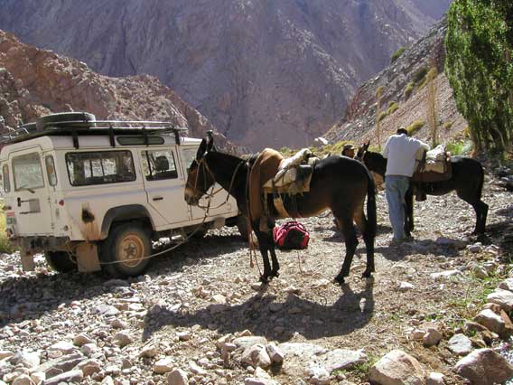
9.02.03. To 2860m above La Molles
We left by Land Rover at 7am for the old bridge, with Eugenie, who would be my muleteer for the next five days, and some other employees of Ramon. After about 20km, a tyre on the trailer we were pulling disintegrated, which didn't take long to fix. A little later, the clutch failed. This was definitely more ominous. Everyone searched the road and found miscellaneous bolts and wires that had dropped off. These were reattached by Ramon, but, while the clutch peddle now felt fine, the clutch would not engage. At this point I could feel Mercedario slipping away again --- clutches are very complicated! But I underestimated Ramon: after about 1 1/2 hours work, the clutch was working perfectly, and we were on our way.
Ramon (crouching) at work on the Land Rover; Eugenie is standing behind him.
About 11am we reached Las Hornillas, where the mules were, and Ramon went back to Barreal. Eugenie caught three mules, and saddled them. In order to be able travel faster, I would ride one mule, and another would serve as a pack mule. We set off across the desert, and after about 3 hours arrived at the Rio Colorado and a grove of trees known as Santa Ana, where we had lunch. Here there were two members of the national gendamerie (what were they doing here in the middle of nowhere? well, they are ubiquitous).
Mostly, we were following a good trail, but on the descent to the Rio Blanca, the trail became so rough that I didn't think a mule could negotiate it. Since sometimes we were passing over small cliffs, this was a bit scary, but my mule seemed to know what he was doing, and so who was I to argue.
Indeed, at one point the pampas was split by a cliff, about four or five feet high. The other mules, with lighter loads were able to leap up it in a single bound. My mule walked back and forth along the cliff until he found a point where there was a small ledge halfway up. He then charged the cliff and made it up by putting some of his (four) hooves on the ledge. Clearly, one smart animal.
Eventually, Eugenie sent me in front followed by the pack mule. At this, my mule became very competitive: when he sensed (with his big donkey ears) that the pack mule was sneaking up on us, he would set off at a great pace, swerving from side to side to prevent his rival passing. Eventually, we passed La Molles, and after 8 hours of riding we stopped --- by then I was so sore, I could barely get off the mule. Within 20 minutes of our stopping, Eugenie had the mules unloaded and hobbled for the night and a fire lit, and I had my tent up and was cooking dinner on my stove.
10.02.03. To Base Camp 4384m
In the morning, the mules climbed 1500m from 2860m to 4384m (GPS readings) in only 3 hours with loads --- about twice as fast as I could have walked it. There were a large group of Argentine soldiers at base camp and a party of 6 Brazilian climbers. I set up camp, and Eugenie took the mules back to where there was vegetation..
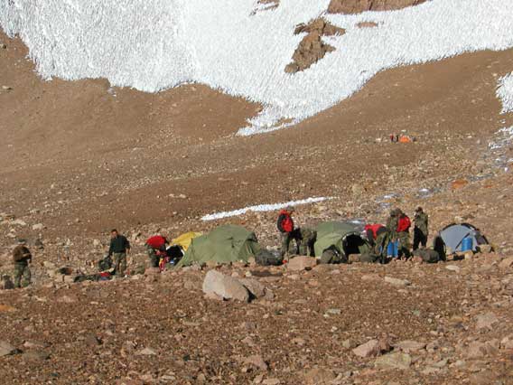
The army tents, with the Brazilian tents behind.
11.02.03. To Pircas Indias 5150m
Climbed to the high camp (770m in 3 hours). Apart from the Brazilians, who straggled up later in the afternoon, I was the only one there.
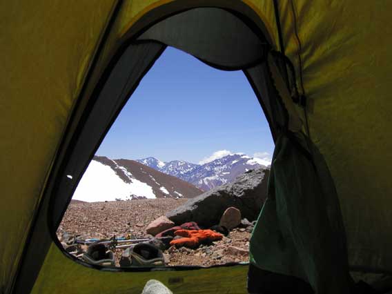
Relaxing in my tent, in preparation for tomorrow's attempt on the summit.
I had told Eugenie that I would be back at base camp (4384m) by 7pm on the 12th. In order to achieve, this I would have to reach the summit of Mercedario (6770m) by 2pm.
12.02.03. Bid for the summit 6770m
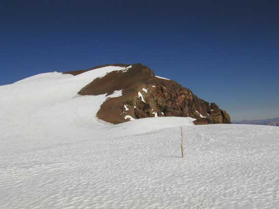
During the night, there were ominously fierce gusts of wind. When I left at 5:40am, the wind was very strong and very cold --- unless it relented, I would have no chance of reaching the top. In two hours I reached some tent sites at about 5650m. Here there was a large flat snowfield with a peak on its southern side. The route is obvious: the obvious peak is the summit, and you climb the obvious ridge to reach. Unfortunately, I didn't know this. The only sketch map I had of the summit area showed the snowfield surrounded by 5 peaks. If it was accurate, the visible peak was a false summit, and the true summit was behind the snowfield to the southwest. I followed a small track to the right of the snowfield, and then tracks marked with wands crossing the snowfield.
Wands on the snowfield (10:02am)
Eventually I decided the wands led nowhere, the sketch map was a fantasy, and the obvious peak was the summit. I headed over to the peak and stopped for lunch. My mistake had cost me almost two precious hours. I was now at 6220m (GPS reading) and it was 11:20am --- I had 2 hrs 40 min to climb 550 metres to the summit up an unpleasantly loose scree slope. I made it with only a few minutes to spare. Miraculously, the wind had relented, and it was almost balmy on top.
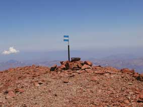
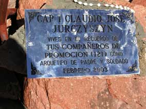
The Argentine flag (2:01pm) and a very recent plaque (2:02pm) on the summit
of Mercedario 6770m
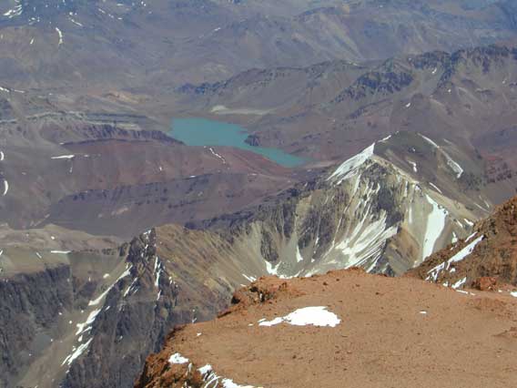
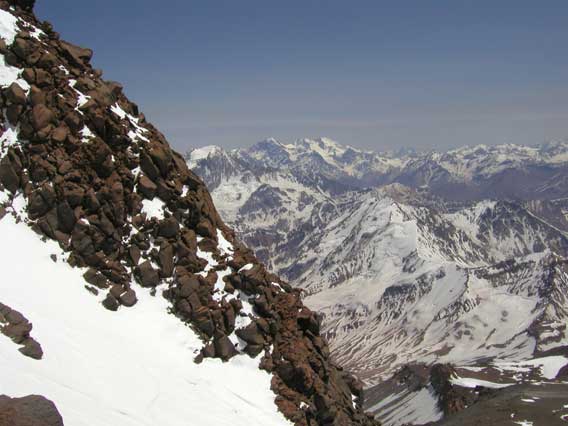
View west towards Chile.
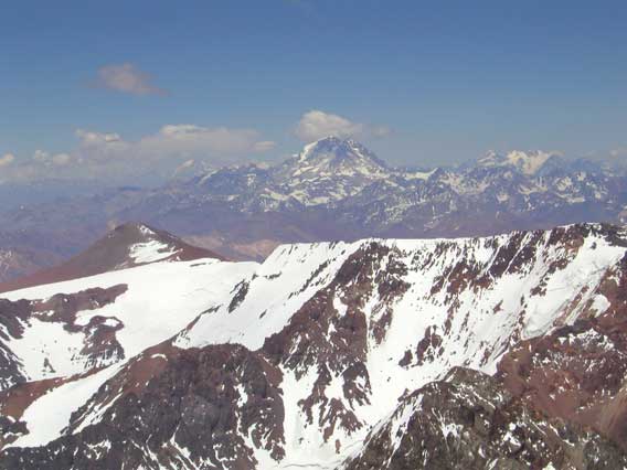
View south towards Aconcagua.
After about 15 minutes enjoying the view, I headed back down the same scree slope, and then down the snow, and back to the high camp. On the way to my tent, I spoke to the Brazilians --- they will probably attempt the summit tomorrow. I reached my tent a little after 5pm. After meal, I packed up and headed down at 6pm to meet Eugenie. On the way I was a struck by a brief storm with some snowfall --- it was a day with everything. When I reached the final slope on the descent, I saw Eugenie arriving with the mules at the now deserted base camp. I descended the 770m in 1 hour (almost mule-speed), and reached base camp as promised at 7pm, almost to the minute. Or, I would have, except that, after 2 weeks of almost impeccable climbing, when only 50 metres from the mules I tripped and fell flat on my face with such force that my nose bled, which delayed my arrival by 5 minutes.
We spent 2 hours riding the mules down to the "Refugio" at 3150m. The last part of the descent was by moonlight, which didn't seem to bother the mules --- mine still insisted on drag races with his arch rival the pack mule on the rough stony trail. By the time we arrived, I had been climbing for 11 1/2 hours, and riding for 2. Surprisingly, although I felt tired, I didn't feel exhausted.
13.02.03 Return to Mendoza
Eugenie has saddled two mules (mine is at left) and is tracking the third
(the nefarious pack mule).
We left about 8:30, and reached the first ford above La Molles, where Ramon was waiting for us with the Land Rover, in less than 2 hours.
Eugenie and Ramon and the mules.
Ramon drove me back to Barreal, while Eugenie took the mules back to Las Hornillas. I had a great lunch at Expediciones Ossa. Mr Orviz arrived about 3pm, and we were back in Mendoza about 6:30.
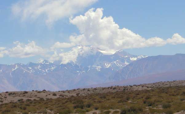
View of Mercedario as we drive back to Mendoza from Barreal
Information
As noted above, Biggar (The High Andes) has only very sketchy information on Tupungato and Mercedario. Kelsey (The Worlds Mountains) has less on Tupungato, but his sketch map for Mercedario is very useful except for the summit area (where it is very misleading --- at least, it misled me).
Casa Orviz can arrange everything for you from Mendoza (transport,
equipment, mules...).
CASA ORVIZ; Juan B Justo 532; Tel. / Phone 0054 261 4251281; 5500 MENDOZA - ARGENTINA
Expediciones Ossa (Barreal) can arrange everything for Mercedario (Ramon
Luis Ossa, TeleFax 0264-8441004;
ossaexpediciones@infovia.com.ar).
www.orviz.com; info@orviz.com; orviz@lanet.com.ar
Postscript.
From Cristian D. González-Avilés, who corrected my spelling of Tupungato: `apparently, this is a Quechua word meaning “balcony to the stars”. I’ve heard that word time and again since I was a kid.'
From Jeremy Rietmann: I was looking at your posting about your climb of Cerro Tupungato. ... I climbed Tupungato by that route from the village of Tupungato in January 2005. I read your report of your climb and I just wanted to let you know that there is a more passable route to the summit. If you have a photo looking up at the peak of the mountain from the high camp at about 18,000ft there is a triangular snowfield on the right that leads up to a broken rock band. After passing the rock band there should be a weakness to the left, up one more sort of steep snowfield to a "cannaletta" that can be hiked up to the top of what is visible in any photo. From there it's about an hour hike to the real summit.